Current windy conditions will melt into wintry mix Sunday
Published 4:29 pm Friday, January 12, 2024
")
Be prepared. (National Weather Service)
")
Be prepared. (National Weather Service)
")
Be prepared. (National Weather Service)
A weather advisory warns residents that strong winds will continue as “severe and significant threat to life or property” heads our way, starting this weekend. That means you still have time to get prepared.
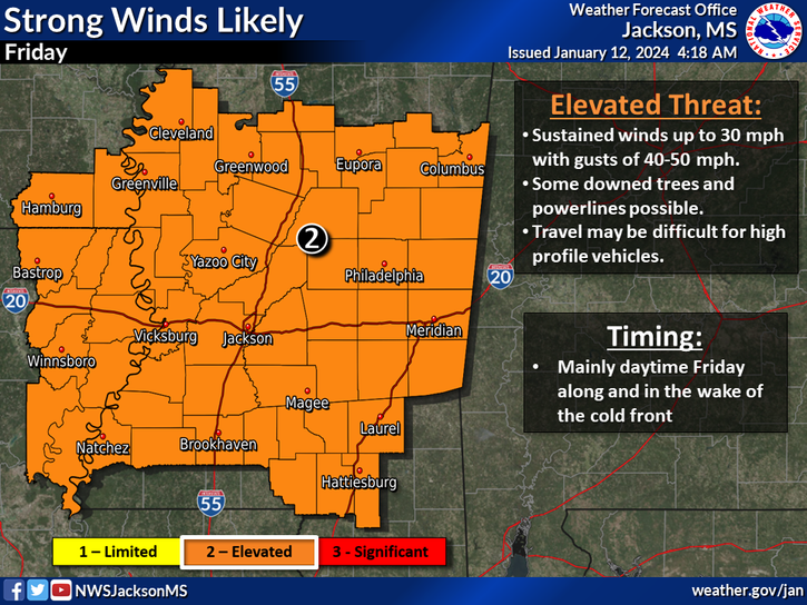
(National Weather Service)
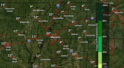
This weekend, The Weather Channel reports that “…heavy mixed precipitation possible… and ice accumulations up to a quarter of inch” are probable. Heavy snow accumulations of 3 to 8 inches are possible, as is flooding, and residents should expect this winter storm watch to continue until 6 p.m. Tuesday. There is also an active wind advisory to complicate things further.
Travel could be very difficult, especially since the hazardous conditions could impact the morning or evening commutes. Plan on slippery road conditions. Icing could also result in power outages so plan accordingly.
The areas under this advisory are in portions of East Arkansas, North Mississippi, Southeast Missouri and West Tennessee. Affected Mississippi counties include the following (as of p.m. Friday):
CLAY … GREENE … CRAIGHEAD … POINSETT … MISSISSIPPI … CROSS … CRITTENDEN … ST. FRANCIS … LEE … PHILLIPS … DUNKLIN … PEMISCOT … DESOTO … MARSHALL … BENTON … TIPPAH … ALCORN … TISHOMINGO … TUNICA … TATE … PRENTISS … COAHOMA … QUITMAN … PANOLA … LAFAYETTE … UNION … PONTOTOC … LEE … ITAWAMBA … TALLAHATCHIE … YALOBUSHA … CALHOUN … CHICKASAW … MONROE … LAKE … OBION … WEAKLEY … HENRY … DYER … GIBSON … CARROLL … BENTON … LAUDERDALE … TIPTON … HAYWOOD … CROCKETT … MADISON … CHESTER … HENDERSON … DECATUR … SHELBY … FAYETTE … HARDEMAN … MCNAIRY … HARDIN